Climate Change
WMO warns of drier conditions in Southern Africa
Farmers, water supplies and household incomes in Southern Africa are at risk from November, when the rainy season normally begins. The World Meteorological Organization (WMO) says the region faces a higher chance of drier conditions as El Niño grows stronger. The warning came on 21 October from Celeste Saulo, the WMO’s Secretary-General, at a press […]
manuel ·Oct 21, 2026 ·3 min read
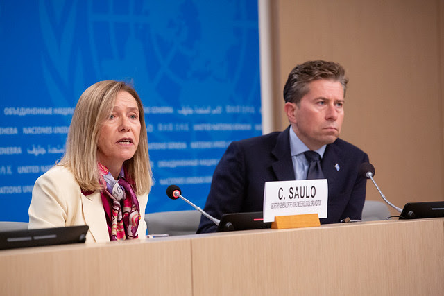
Farmers, water supplies and household incomes in Southern Africa are at risk from November, when the rainy season normally begins. The World Meteorological Organization (WMO) says the region faces a higher chance of drier conditions as El Niño grows stronger.
The warning came on 21 October from Celeste Saulo, the WMO’s Secretary-General, at a press conference with Tom Fletcher, the UN’s top humanitarian affairs official. The new forecast says this El Niño could be stronger than anything recorded in the last 40 years. Saulo said it could go “off the monitoring charts” scientists have used for four decades.
What is El Niño?
El Niño is a warming of the Pacific Ocean that shakes up weather around the world. This one should peak near the end of 2026, but its effects will last well beyond that. The WMO says the sea surface temperature in the tropical Pacific could reach 3.8°C above average between November 2026 and January 2027.
What it means for Southern Africa
Less rain can hurt crop production, cut water supplies and put people’s livelihoods at risk. The WMO says this is a seasonal outlook, not a prediction of any single event, so local and national forecasts will show where and when action is needed.
What about the rest of Africa?
East Africa could see the opposite problem. Wetter-than-normal conditions are more likely in parts of the region during the October to December rainy season, which raises the risk of heavy rain and floods.
Other parts of the world
Southeast Asia: Hotter weather and less rain could mean more heat exposure and pressure on farming and water. More wildfires and smoke haze are already being seen.
The Americas: More rain is expected in the northwest US and the southern part of western South America, where flooding has already hit Chile and the Parana basin. North America and the northern Caribbean are also likely to get more rain than normal. Parts of Central America, the southern Caribbean and the Amazon face a higher risk of drought.
Who is hit hardest
Saulo’s biggest worry is people already living on the edge, like refugees, families in conflict zones and people who have lost their homes. In those places, housing, clean water, sanitation and health care are already stretched, and extreme weather makes things worse.
It does not have to be a disaster
Saulo said a strong El Niño does not have to become a humanitarian crisis. The science, forecasts and early warning systems already exist to save lives and protect livelihoods.
The WMO and the UN’s humanitarian office (OCHA) are calling on governments and aid groups to act early, before the droughts, floods and heat arrive. The window for getting ready is still open in many places, but it will not stay open forever.
In Saulo’s words, we cannot stop El Niño, but we can prevent many of its worst effects on people.